
The Ministry of Environment, Urbanization and Climate Change of Türkiye has officially launched public access to the National Geospatial Information Platform by integrating it into the e-Government (e-Devlet) system. As of January 1, 2025, the platform — previously accessible only by public institutions — is now available to citizens with controlled access, making critical geographical data accessible to individuals, academics, and the private sector.
A New Era for Geospatial Transparency and Access
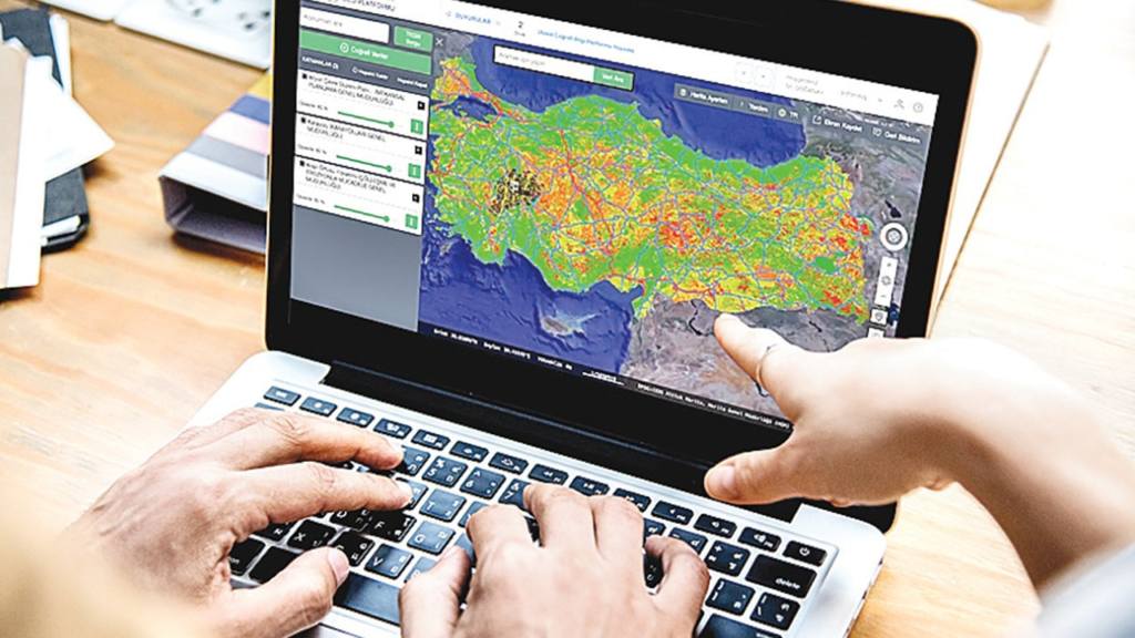
According to the ministry’s statement, the General Directorate of Geographical Information Systems has developed this platform to provide a centralized access point for all types of geospatial data. Citizens can now log in to the portal using their e-Government credentials via www.tucbs.gov.tr or www.turkiye.gov.tr, accessing a wealth of location-based information ranging from zoning plans to natural disaster risk assessments.
This digital breakthrough aims to increase transparency in real estate and urban planning, improve access to vital data for scientific research, and empower citizens with tools to make informed decisions regarding land purchases, urban development, and environmental safety.
How Citizens Can Use the Platform
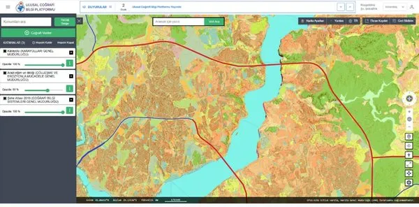
With the National Geospatial Information Platform, users can access over 630 geospatial data layers through a simplified and secure interface. The platform offers a user-friendly Geospatial Data Request Portal, enabling individuals and professionals to obtain high-quality, real-time data on various subjects, including:
Zoning and urban development plans
Infrastructure status (electricity, water, sewage)
Green spaces and recreational areas
Transportation infrastructure and accessibility
Soil type and quality
Water resources near agricultural lands
Disaster risks, including earthquake zones, flood plains, and landslide areas
Whether you are looking to purchase a residential property, invest in rural farmland, or analyze a specific region’s environmental characteristics, the platform provides a map-based interface where all relevant data can be visually explored and downloaded when needed.
Supporting Research, Industry, and Sustainability
In addition to helping the public, the platform plays a pivotal role for academics, urban planners, environmentalists, engineers, and real estate developers, offering validated and standardized geospatial data critical to project planning and development.
Each dataset uploaded to the system is automatically verified for compliance with national geospatial standards, ensuring data accuracy, currency, and reliability. Moreover, the platform features a Geospatial Data Dictionary, which standardizes terminology across all government institutions and private entities. This harmonization reduces confusion, avoids data duplication, and enhances inter-agency cooperation.
Enhancing Safety Through Data: Earthquake and Landslide Awareness
One of the standout features of the platform is its integration of natural disaster risk maps. Citizens can view real-time data related to:
Earthquake-prone areas
Landslide risk zones
Flood risk maps
Historical fault lines and active seismic zones
This functionality is particularly important in Türkiye, a country prone to seismic activity. By offering easy access to these risk maps, the platform enables homeowners, builders, and municipalities to make safer, more resilient decisions when it comes to construction, relocation, or investment.
A Digital Leap for Smart Urban Planning
This initiative is not just a convenience for citizens — it’s a step toward smart city development. Ministries and municipalities can now use the platform to:
Accelerate urban planning approvals
Streamline permit and licensing workflows
Manage environmental impact assessments
Design sustainable transportation systems
Coordinate emergency response and disaster preparedness
By centralizing and democratizing geospatial information, Türkiye aims to reduce bureaucracy, enhance data transparency, and foster a culture of evidence-based decision-making at all levels of government and society.
Democratizing Data Access
The controlled access feature ensures that sensitive data is protected, while still granting meaningful access to the public for day-to-day needs. Whether you are evaluating a neighborhood to purchase a home, analyzing agricultural productivity, or researching floodplain boundaries for a project, the system provides official, centralized, and real-time information at your fingertips.
Moreover, the system is designed with data ethics and privacy in mind. Users only access datasets relevant to their queries, and governmental institutions maintain full oversight over data integrity.
Looking Ahead
With this integration into e-Devlet, Türkiye becomes one of the few countries to offer nationwide geospatial data to citizens in a digitally secure and legally compliant manner. The National Geospatial Information Platform is poised to transform urban development, boost disaster resilience, and democratize access to environmental data.
The project reflects Türkiye’s long-term vision to modernize its digital infrastructure and ensure that both citizens and institutions are equipped to meet 21st-century challenges — from housing and energy to climate change and urban sustainability.