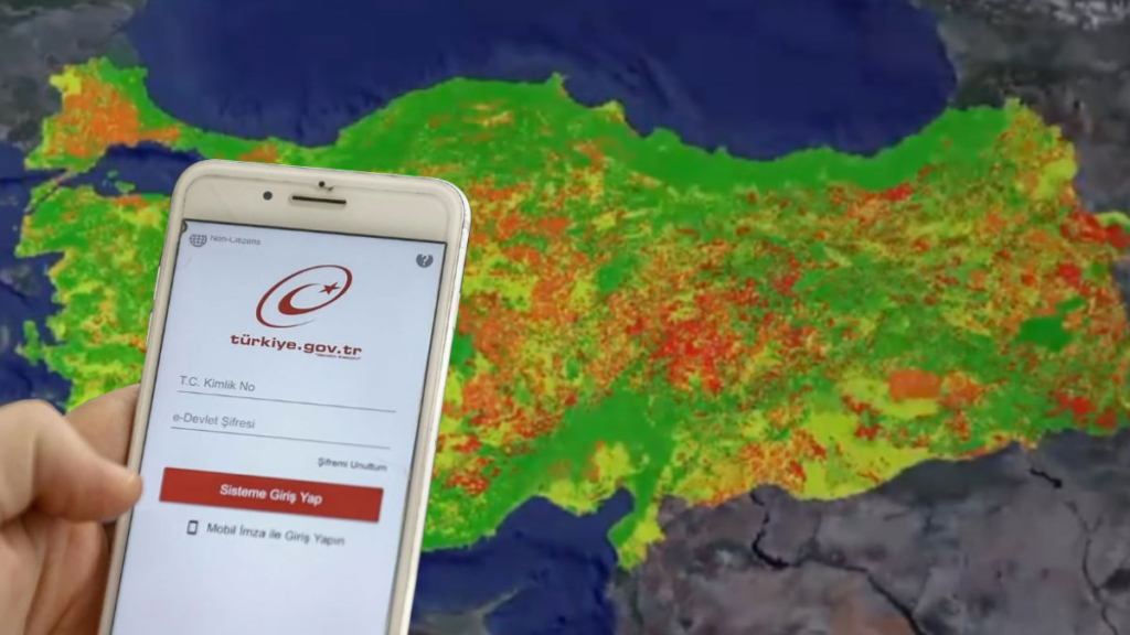

In a major step toward data transparency, digital integration, and smarter urban planning, Türkiye’s Ministry of Environment, Urbanization and Climate Change has officially opened the National Geographic Information Platform (TUCBS) to public access via the country’s e-Government Gateway. Initially launched for public institutions on January 1, 2025, the platform is now available—with controlled access—to citizens, academics, and private sector professionals alike.
By making high-resolution geospatial data available through an intuitive online portal, Türkiye is aiming to transform how individuals and institutions engage with information critical to real estate, infrastructure, disaster risk, environmental management, and rural development.
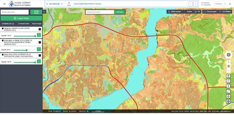
Direct Access to Geospatial Data via Interactive Maps
Users can log in to the platform using their e-Government credentials at either www.tucbs.gov.tr or turkiye.gov.tr. Once inside, they are greeted with an advanced map-based interface that provides seamless access to over 630 distinct geospatial data layers.
From utility lines and zoning information to soil types and seismic fault lines, the platform’s GeoData Request Portal provides a holistic view of Türkiye’s geographical infrastructure. Users can search specific coordinates, zoom in on neighborhoods, and overlay multiple data layers for comparative analysis—all in real time.
Empowering Smarter Land and Property Decisions
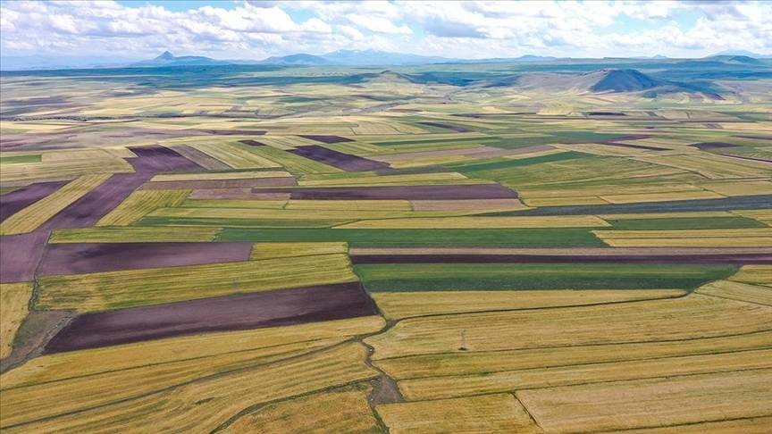
One of the most promising features for everyday users is the ability to access detailed information about land parcels and housing zones. Whether purchasing a home in an urban center or investing in agricultural land in rural regions, the platform provides essential data for informed decision-making.
For instance, a user exploring a piece of land can instantly check its zoning status, availability of electricity and water infrastructure, and proximity to public services. Meanwhile, prospective homebuyers can review neighborhood characteristics such as green space availability, transportation access, and nearby schools or parks.
Agricultural landowners are not left out either. They can examine surrounding soil types, irrigation sources, and land use classifications—factors critical for crop selection and yield prediction.
Disaster Preparedness and Risk Management Tools
In a country like Türkiye—where seismic activity, floods, and landslides are persistent concerns—the availability of accurate risk data is vital. The platform includes information on:
Earthquake risk zones
Landslide-prone areas
Floodplains and streambeds
Public institutions can now integrate this data directly into urban planning, zoning permits, infrastructure development, and emergency response strategies. The platform ensures that all shared data adhere to national standards, enhancing its credibility and utility for mission-critical operations.
This system also supports early disaster warning frameworks by allowing local governments to layer historical and real-time data, thus making faster and more precise decisions in emergency scenarios.
Standardized Data Language Across Institutions
One of the key technical features of the platform is its built-in “Data Dictionary.” This glossary ensures that all geographic data across Türkiye is generated and interpreted using a standardized terminology. The dictionary harmonizes terminology among agencies and prevents miscommunication or data redundancy, making inter-agency collaboration more efficient.
For example, when two different institutions refer to “green space” or “flood zone,” they now use exactly the same parameters and definitions, removing ambiguity and accelerating project execution timelines.
An Open Gateway for Academia and the Private Sector
Beyond government and public users, the platform is designed to support research, innovation, and development across various sectors. Academic researchers can tap into verified datasets to support theses, policy studies, and GIS-based modeling. Meanwhile, private sector companies can use the data to plan logistics, construct digital twins of cities, or develop location-based services and applications.
Startups working in agritech, real estate, mobility, and urban analytics now have a trusted, government-backed data source for building solutions that align with national infrastructure and legal frameworks.
Toward a More Transparent and Digital Türkiye
The introduction of the National Geographic Information Platform marks another milestone in Türkiye’s transition toward open governance and digital transformation. It aligns with broader national strategies that prioritize:
Public access to real-time, high-value data
Smart city development
Efficient infrastructure planning
Environmental protection and climate resilience
In an era where accurate data shapes everything from construction permits to emergency responses, the democratization of geographic information is a powerful move toward greater accountability and civic empowerment.
Ongoing Development and Public Awareness Campaigns
The Ministry of Environment, Urbanization and Climate Change has emphasized that the system will continue to evolve. Ongoing efforts include:
Expanding the number of available data layers
Integrating satellite imagery and AI-driven predictive maps
Enhancing mobile access and user interface design
Launching public awareness campaigns and training workshops
The government is also encouraging feedback from users to improve functionality and ensure that the platform serves all segments of society effectively.
Why This Matters for Everyday Citizens
While the platform’s scale and technological architecture are impressive, its real strength lies in practical application. Whether you’re a citizen curious about flood risk in your neighborhood, a small business owner evaluating a retail location, or a parent checking local parks and schools, this tool offers unparalleled access to trusted data.
In addition to offering transparency, it promotes a more inclusive planning culture—where everyday people can make data-driven choices about their lives and communities.
Looking Ahead
As Türkiye faces the dual challenges of rapid urbanization and climate change, the National Geographic Information Platform emerges as a timely and powerful tool. It fosters collaboration between citizens, academics, and government agencies—turning raw data into actionable intelligence.
With continued updates, education efforts, and integration across sectors, the platform is poised to become an indispensable part of Türkiye’s digital public infrastructure.